When Henry VII visited Bristol in 1486 was he obliged to DISMOUNT or USE OTHER PATH on his pilgrimage to the holy well of St Anne?
He rode into town from Gloucester and was greeted by crowds at the High Cross. He then went onto the Abbey of St Augustine, now the cathedral, where he spent the night. Then, after breakfast, his entourage rode east “to Saint Anne’s in the Wodde”.
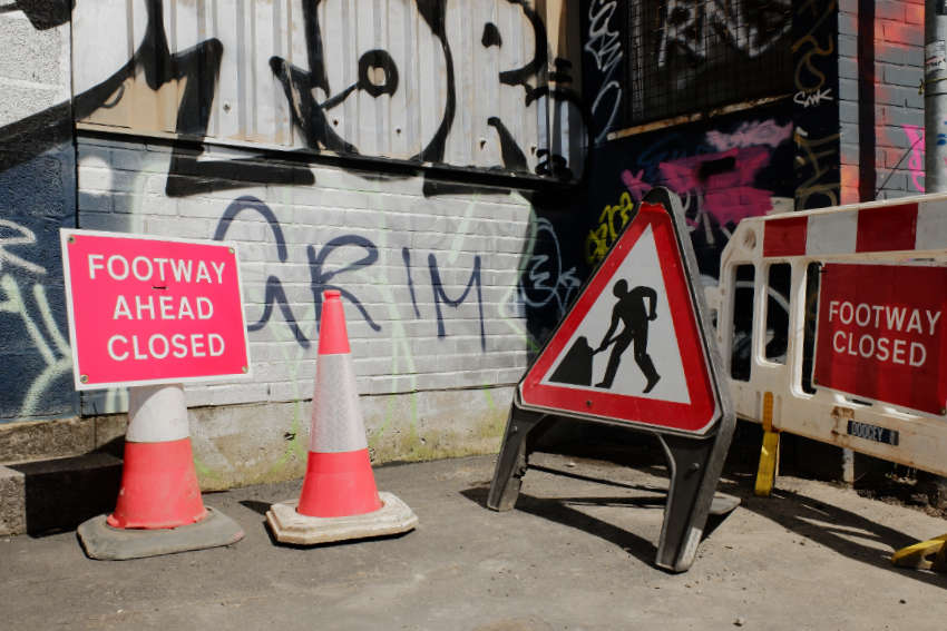
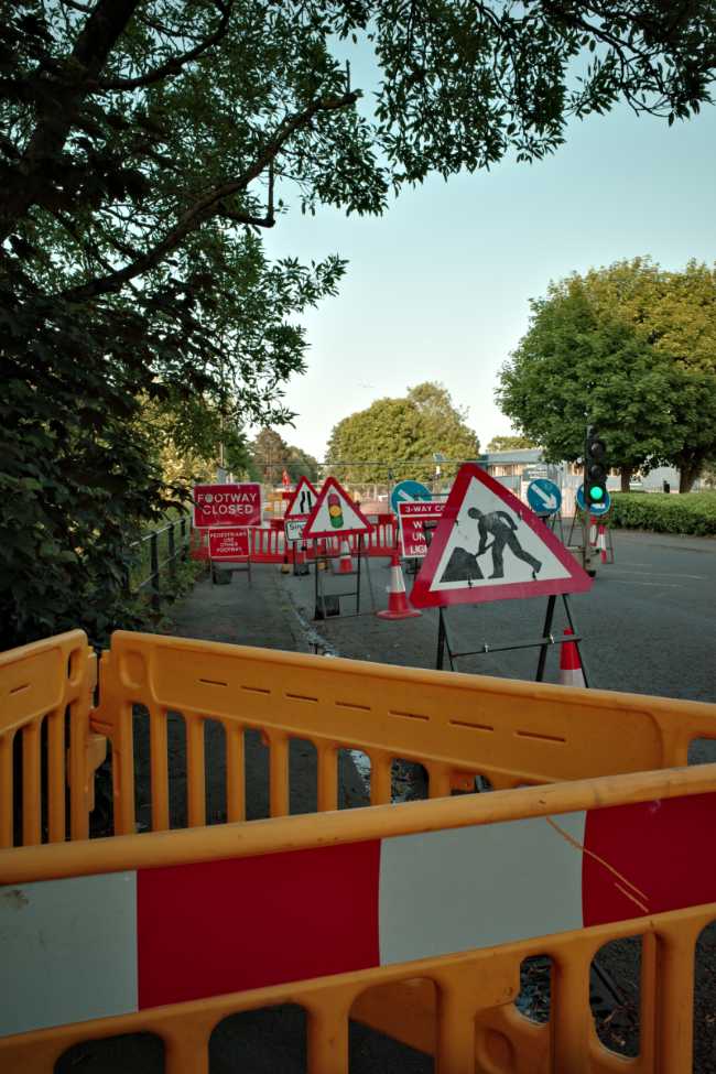
In the 15th century his route would have been across marshes and meadows. If he tried that today he’d find himself trapped in a chaos of construction work, road closures and diversions, as this part of Bristol reinvents itself once again.
Five hundred years ago St Philips and the land beyond was a pestilent rural bog. Later, it was industrialised with a canal, known as the Feeder, and endless acres of railway yards, miles of railway lines, and factories surrounded by terraced houses.
In the post war period, the terraces and factories came down to be replaced by tower blocks and industrial estates.
Now, in its latest phase, brownfield is being replaced by glass-fronted offices, or by blocks of flats for students and twenty-somethings who need somewhere to spend their hours of stasis.

One development, surrounded by temporary walls that have stolen an entire pavement and half the road, describes itself, thanks to some badly formatted text, as “A place a building that for puts people first people.”
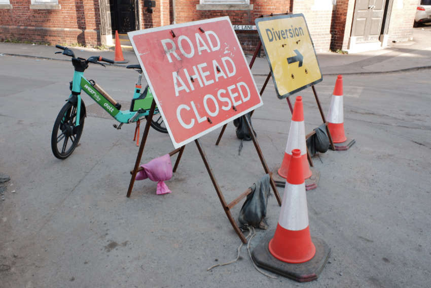
Another development on Gas Lane (a street name that absolutely does not play into aspirational corporate branding and sounds like an address from an episode of Hancock’s Half Hour) closed an entire road for more than a year. Pedestrians can still pass, if they don’t mind squeezing along a gap between hoardings – a dark, narrow pathway that might have been designed by the management committee of the Muggers Union.
This block was surrounded by hoardings depicting the building that was supposed to emerge from the wreckage. A beautiful girl stared into the middle distance, enjoying the tranquillity of a student common room. A bearded young man laughed near a vegan cookbook. Imagined street scenes included computer generated characters, Blade Runner replicants, or perhaps Sims, clutching textbooks or locking up bikes. A dreamed-of Netherlands.
In reality, when you walk past these student blocks, the common areas look uncanny and sparse. There might be a couple of students. They tend to look rather as if they’ve accidentally been locked in a branch of Costa Coffee overnight. The students you see outside are usually dressed in pyjamas and Crocs, vaping as they wait for Deliveroo riders to arrive.

For now, though, if you want to stick to something like Henry VII’s route, you have to push past rows of signs and columns cones, squeeze between temporary fences, evade robotic security sentinels that shout at you if you linger too long, and leap muddy puddles in a road surface turned into no-man’s-land by the constant passing of concrete mixers.
There is a nail house to enjoy, of course – a post-war garage that has refused to be knocked down and from which, after dark, coloured lights and muffled music project into the street. Sometimes, an espresso machine also gurgles. There might be the smell of apple-scented tobacco.
At the end of Gas Lane is Silverthorne Lane, its near right-angled kink watched over by the Viollet-le-Duc Victorian Disneyland dream that is St Vincent’s Works – a folly, a blast of turreted camp. Which way to St Anne’s Wodde from here? Well, choose your own adventure.
Follow Silverthorne Lane straight ahead and you’ll see what remains of a row of Victorian factory buildings whose grand gates recall London’s East India Docks. The factories themselves have been demolished, or are being demolished, with only their most picturesque (listed) features being preserved for incorporation as part of the “Silverthorne Lane masterplan”.
At present, the street is cluttered with more temporary signs, more fencing, and articulated lorries wedged where they shouldn’t be, bossed around by dejected banksmen.
A small city is already emerging from the wasteland. First, there were grey concrete lift towers shooting upwards, floor numbers marked in massive sans-serif. Now there are mostly complete buildings with sheets of plastic flapping around their windows.
For a year or so, this was the preferred dump site of a particularly audacious flytipper – the Arsène Lupin of illegal waste disposal. Fresh piles of crap appeared every night until they all but covered the road. The culprit was caught and prosecuted, eventually.
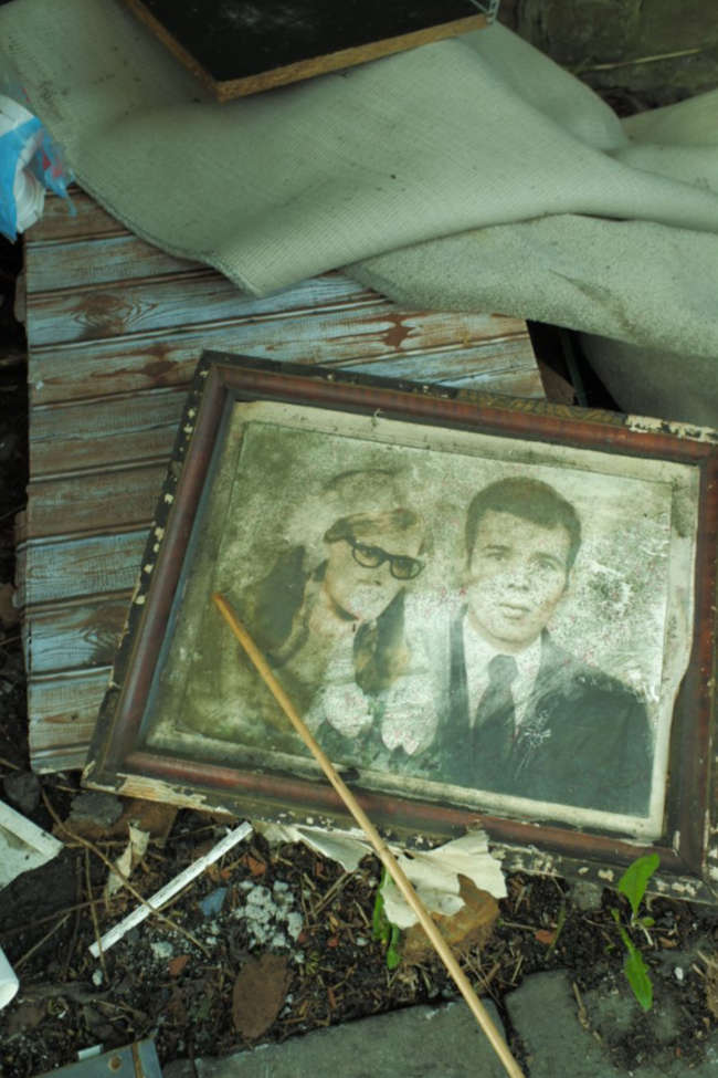
Others continue his work, though, and there are usually piles of waste to be found somewhere nearby: fridges, mattresses, building rubble, bags for life full of empty cider cans, stacks of DVDs, mouldering family portraits, sofas, cans of used cooking oil…
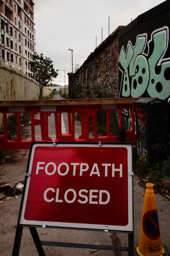
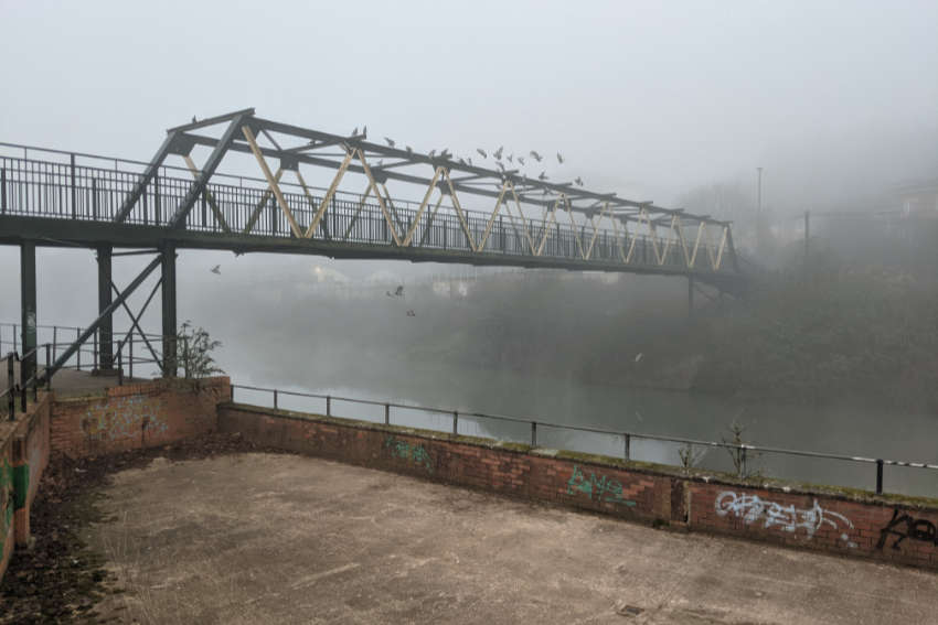
You might, at this point, want to slip up the alleyway beside the tower blocks, Silverthorne Passage, now it’s finally reopened after a year or so of temporary fences, forbidding signs, and torn up paving. It leads to a footbridge over the Feeder Canal.
Or you can push on, into the tunnel beneath the railway line that runs to Temple Meads. There’s a ledge covered in bricks, bottles and cans and, sometimes, a bivouac tent. The road surface is thick with mud, hosed away from the building site towards drains that can’t handle it. Somebody keeps removing stones from the walls and using the damp black holes to stash contraband.
At the other end of the tunnel is the entrance to Network Rail’s Queen Anne Depot (“Warning: Do Not Trespass on the Railway”) from which minibuses loaded with hi-vis maintenance commandos come and go throughout the day and night.
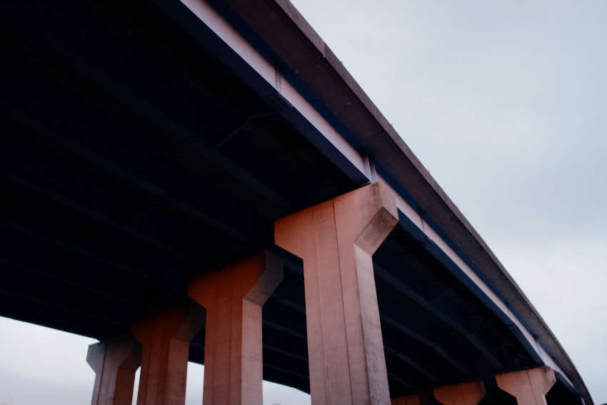
There’s also St Philip’s Causeway, a concrete flyover constructed in the 1970s, which reminds me that when Henry VII entered Bristol in 1486 it was by a “causey way” somewhere in the suburbs. This causeway is high in the air and cars and trucks passing overhead create percussion which is picked up by the reverb in the vast space beneath: ba da dum, beat, ba da dum, beat, dum, dum, dum.
There’s one more bridge, a backup railway line mostly used by freight trains, and known by those in the know “the Rhubarb Loop”. It’s called that because it passes above The Rhubarb Tavern, which was itself named for nearby rhubarb fields.
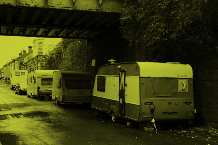
The Rhubarb is tinned up at present while its owner, a property developer based in London, grapples with tenacious locals who want a pub, not more flats. While the battle goes on, a local collector of junk and caravans has moved into the dead space at the side of the pub. More caravans are parked nearby, beneath the Rhubarb Loop. At night their windows are illuminated by flickering candles.
Follow Queen Ann Road (derelict Victorian school) through Barton Hill (Corbusian tower blocks) along Avonvale Road (construction hoardings, ugly gaps where Victorian buildings used to be) and onto Marsh Lane. Now you’re back on the right track, with Netham Park (polluted land reclaimed from a former chemical works) on your left and an unnamed common on your right. Old maps show a mysterious ‘Stone’ here but I’ve kicked around in the grass for hours and can’t find it. Then cross the Feeder and…
(Let’s turn back to the page we marked, at the end of Gas Lane, and try a different route.)
Go right at St Vincent’s Works and follow Silverthorne Lane for another way to reach the Feeder. Of course it is half-blocked by building works. Temporary lights torture drivers until, by the time they get halfway home, or halfway to work, they’re behaving as if they’re in a Mad Max movie, jumping lights and mounting pavements, aiming for high-scoring pedestrians.
Motion, the legendary student nightclub which occupied old industrial buildings, is now dead and shuttered. Nearby, new student towers in red brick have replaced mechanics’ yards and factories, which in turn replaced abattoirs, cattle pens and quarantine hospitals many years ago.
Car dealerships line the Feeder. Is there a type of building with less soul than these big, blank temporary boxes? One by one they’re emptying, too, their sites awaiting redevelopment. One occupies the former site of a Victorian church, long demolished, and is now in the process of collapsing itself, its metallic flanks embraced by thick-stemmed weeds.
Between the dealerships are junkyards, cafes, workshops and a rehearsal space from which the sound of clattering drums comes at all hours of the day.
Eventually, at Netham Lock, the Feeder reaches the River Avon. Here, you might see a heron. You might see rowers from the university. You might see a tree blown down in a storm making its leisurely way into town.
How did Henry VII cross the Avon? By a ferry that ran for centuries where Blackswarth Road meets the river. To replicate his route, walk along the river path and cross the footbridge that leads from the ruins of a concrete works to the site of the old mill, now a shopping precinct car park. On summer evenings, local car enthusiasts gather here to admire each other’s hatchbacks and rev their engines.
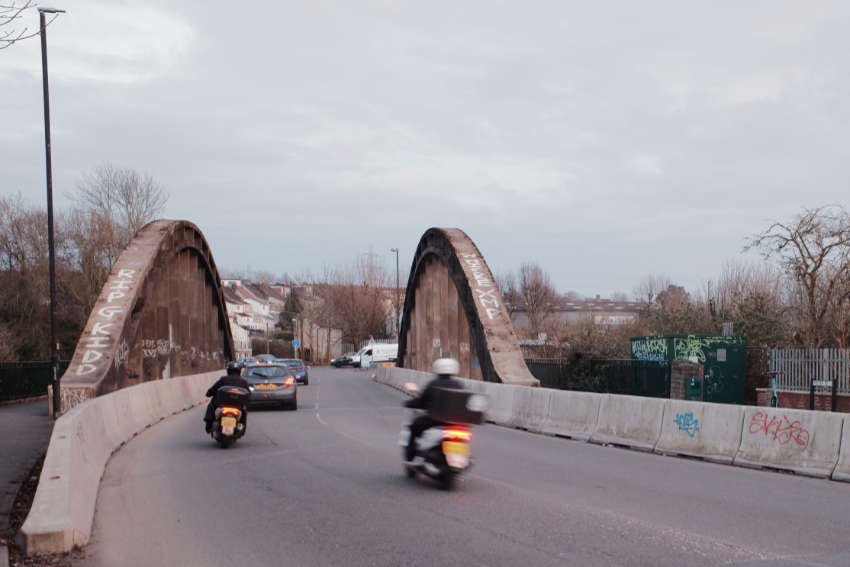
Let’s stick to the road, though, and use the concrete suspension bridge that looks as if it belongs in Berlin, perfect for the exchange of spies.
On the other side is St Anne’s where the world between industrial units begins to turn green. Depending on the time of year, you’ll find fallen apples, scattered cherries, or brown leaves beneath your feet. Or you might tread through the daffodils that fill the pointed corner where four roads meet.
Follow St Anne’s Road, with parcel depots on one side and a rising green bank on the other, and you’ll eventually reach St Anne’s House, a post-war office block now used by various community groups. Wander to one side, up Chapel Way, and on the side of St Anne’s House, by the bins, above a community defibrillator, you’ll find a plaque:
Near this memorial is the site of St. Anne’s chapel, a 14th century shrine, founded by one of the lords de la Warr, and attached to the abbey of Keynsham. Before its dissolution in 1538 it was a place of pilgrimage visited by many distinguished persons including King Henry VII in 1486, and his queen, Elizabeth of York 1502.

An often-quoted description by William Worcester, from his 1480 survey of Bristol, tells us what was lost:
The Chapel of St. Anne contained in length 19 yards… The breadth contained 5 yards… And there are 19 buttresses about the Chapel… Also, there are two four-sided wax lights: one, the gift of the Weavers’ Guild, which contained in height from the ground to the arch of the roof 80 feet. And the through measurement of one four-sided wax light from the Guild of Cordwainers contains in width 10 inches, and in breadth 8 inches. And the four-sided wax light given by the Guild of Weavers contains in height to the roof of the Chapel 80 feet, width 8 inches, breadth 7 inches… And there are in the said Chapel 32 ships and boats, and five of the ships are of silver… And before the image of St. Anne are 13 four-sided wax lights.
Everybody seems to doubt the likelihood of these 80 foot tall candles. But who knows.
Continue along St Anne’s Road and, by the roundabout near Co-Op, you’ll reach a gate which leads to a muddy path into The Wodde. Follow the path up, past garages, sheds, and overgrown flytips that have become part of the landscape, then steeply down to a trickling stream.
The best time to visit the Wodde is in spring when an absurd abundance of wild garlic covers the ground and scents the air. It can seem idyllic, cut off from the world, birdsong louder than traffic sounds for once. Or you might find a burned out moped blocking your way.
The stream will lead you to the holy well, ringed with black railings. There are scraps of tattered, mouldy fabric hanging from the branches above, including face masks from the pandemic.
I don’t know whether Henry VII drank from the well or washed in the water. You can’t do either now, and probably wouldn’t want to.
